category :: cultural
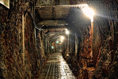
Ombilin Coal Mine
The Ombilin Coal Mine, a UNESCO World Heritage site in Indonesia, recognized in 2019, is a colonial-era mining complex in West Sumatra developed by the Dutch from 1892 to extract high-quality coal. Featuring a company town, railway, and mining facilities set in a volcanic landscape, it reflects advanced industrial planning and forced labor history under colonial rule. This site showcases Indonesia’s early industrial heritage, blending European technology with local adaptation in a remote tropical region.
Risco Caido
Risco Caído, a UNESCO World Heritage site in Spain, recognized in 2019, is a sacred cultural landscape on Gran Canaria, preserving the pre-Hispanic heritage of the Canary Islands’ Indigenous people from the 6th to 15th centuries CE. Featuring cave temples, granaries, and settlements carved into volcanic cliffs, it includes a remarkable astronomical site where sunlight marks seasonal shifts. This rugged terrain reflects Spain’s ancient insular culture, showcasing a unique blend of architecture, spirituality,... Read More
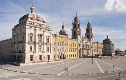
Mafra Palace
Mafra Palace, a UNESCO World Heritage site in Portugal, recognized in 2019, is an 18th-century Baroque masterpiece built under King João V near Lisbon, combining a royal palace, basilica, and monastery. Renowned for its grand scale, intricate architecture, and a library housing rare manuscripts, it also boasts one of the world’s largest carillon bell sets. This opulent complex reflects Portugal’s wealth and cultural ambition during its colonial peak, showcasing a harmonious blend of art, faith, and regal po... Read More
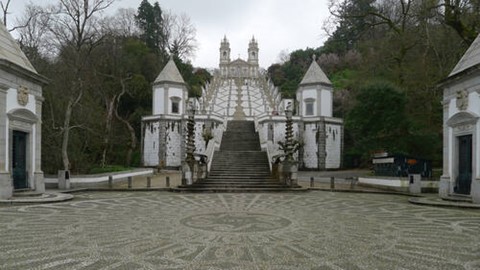
Bom Jesus do Monte
The Sanctuary of Bom Jesus do Monte in Braga, a UNESCO World Heritage site in Portugal, recognized in 2019, is a Baroque pilgrimage site begun in the 17th century atop a hill near Braga. Famous for its dramatic zigzag staircase, ornate chapels, and hilltop church, it blends architecture with landscaped gardens in a sacred setting. This devotional complex reflects Portugal’s rich religious heritage and artistic mastery, drawing pilgrims and visitors to its striking fusion of faith and natural beauty.
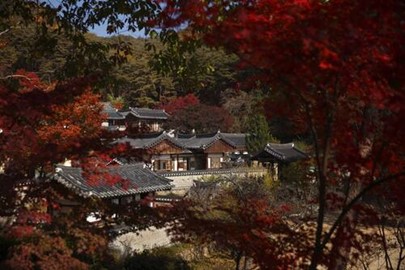
Seowon, Neo Confucian Academies
Seowon, Korean Neo-Confucian Academies, a UNESCO World Heritage site in South Korea, recognized in 2019, are nine historic learning centers from the Joseon Dynasty (15th to 19th centuries), exemplifying Neo-Confucian ideals. Nestled in rural landscapes, these wooden complexes, like Sosu Seowon, blend architecture with nature, featuring lecture halls, shrines, and libraries that fostered scholarship and ethics. This network reflects Korea’s intellectual heritage, showcasing a unique educational tradition tha... Read More
Frank Lloyd Wright Architecture
The Frank Lloyd Wright Architecture, a UNESCO World Heritage site in the USA, recognized in 2019, comprises eight iconic buildings designed by Frank Lloyd Wright between 1905 and 1938, showcasing his revolutionary organic architecture. Highlights include Fallingwater, with its cantilevered design over a waterfall, and the Guggenheim Museum’s spiraling form, reflecting harmony with nature and innovative spatial concepts. These works reflect Wright’s profound influence on 20th-century design, embodying Americ... Read More
Water Management System of Augsburg
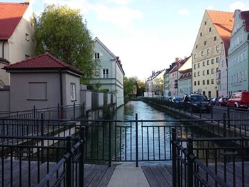
The Water Management System of Augsburg, a UNESCO World Heritage site, showcases over 700 years of innovative hydraulic engineering, evolving from the 14th century to today. It features a sophisticated network of canals, historic water towers, monumental fountains, and hydroelectric power stations that still provide sustainable energy. This system, which separated drinking and process water as early as the 15th century, highlights pioneering technological advancements that supported urban growth and establi... Read More
Writing on Stone / Áísínai’pi
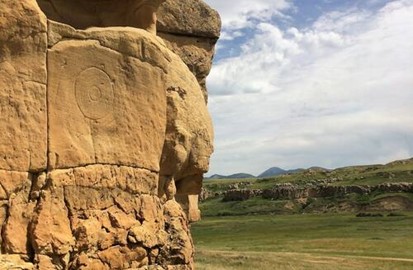
Writing-on-Stone / Áísínai’pi, a UNESCO World Heritage site in Canada, is a sacred landscape renowned for its striking geological formations and rich cultural history. The site features thousands of Indigenous rock carvings and paintings, some dating back over 3,000 years, created by the Blackfoot and other First Nations peoples. These petroglyphs and pictographs, etched into sandstone cliffs and hoodoos, depict spiritual visions, battles, and daily life, offering a profound glimpse into ancient traditions.... Read More
Qhapaq Ñan
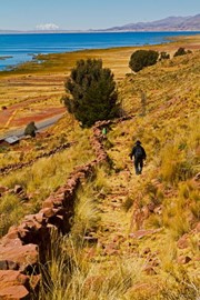
Qhapaq Ñan, Andean Road System, a UNESCO World Heritage site in South America, recognized in 2014, is a vast Incan road network spanning six countries—Argentina, Bolivia, Chile, Colombia, Ecuador, and Peru—built from the 13th to 16th centuries. Stretching across mountains, valleys, and deserts, this engineering marvel linked communities, facilitated trade, and supported the Inca Empire’s administration with stone paths, bridges, and rest stops. This transnational site reflects South America’s pre-Columbian ... Read More
Jesuit Missions of the Guaranis
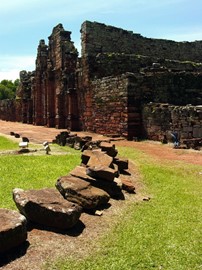
The Jesuit Missions of the Guaranis, a UNESCO World Heritage site in South America, recognized in 1983 and 1984, are five 17th- and 18th-century mission ruins across Argentina, Brazil, and Paraguay, built to convert and protect Guarani Indigenous peoples. Featuring baroque churches, workshops, and communal layouts amid lush landscapes, they reflect a unique fusion of European and Indigenous cultures under Jesuit stewardship. This transnational site showcases South America’s colonial history, highlighting a ... Read More
Prehistoric Pile Dwellings
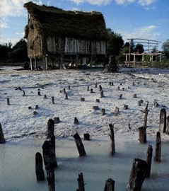
The Prehistoric Pile Dwellings around the Alps, a UNESCO World Heritage site in Europe, recognized in 2011, are 111 archaeological sites across six countries—Austria, France, Germany, Italy, Slovenia, and Switzerland—dating from 5000 to 500 BCE. These ancient lakeside villages, built on stilts over water or wetlands, feature wooden remains and artifacts revealing Neolithic and Bronze Age life. This transnational network reflects Europe’s early settlement ingenuity, offering a rare glimpse into prehistoric a... Read More
Fertö / Neusiedlersee
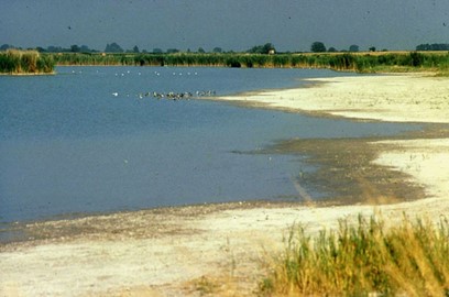
Fertö / Neusiedlersee, a UNESCO World Heritage site in Austria and Hungary, recognized in 2001, is a cultural landscape around Central Europe’s largest steppe lake, shaped by millennia of human activity. Featuring reed beds, vineyards, and historic villages, it blends natural beauty with traditional farming and winemaking from Roman times to the present. This cross-border site reflects a harmonious coexistence of people and nature, showcasing Austria and Hungary’s shared cultural heritage in a unique wetlan... Read More
Struve Geodetic Arc
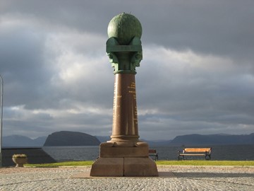
The Struve Geodetic Arc, a UNESCO World Heritage site in Europe, recognized in 2005, is a network of 34 survey points across 10 countries—Belarus, Estonia, Finland, Latvia, Lithuania, Norway, Moldova, Russia, Sweden, and Ukraine—established by astronomer Friedrich Georg Wilhelm Struve between 1816 and 1855. Stretching over 2,820 kilometers, these markers measured the Earth’s meridian arc, advancing geodesy and mapping precision. This transnational site reflects Europe’s scientific heritage, showcasing a mon... Read More
Belfries of Belgium and France
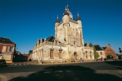
The Belfries of Belgium and France, a UNESCO World Heritage site recognized in 1999 and expanded in 2005, are 56 medieval civic towers across Belgium and northern France, built between the 11th and 17th centuries. Symbolizing urban autonomy and power, these belfries, often part of town halls or cloth halls, feature intricate Gothic and Renaissance designs with bells for signaling time and events. This transnational site reflects the region’s rich civic heritage, showcasing architectural innovation and the r... Read More
The Architectural Work of Le Corbusier
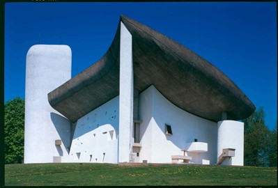
The Architectural Work of Le Corbusier, a UNESCO World Heritage site recognized in 2016, spans 17 modernist buildings across seven countries—Argentina, Belgium, France, Germany, India, Japan, and Switzerland—designed by the Swiss-French architect Le Corbusier from the 1920s to 1960s. Featuring iconic structures like the Villa Savoye and Chandigarh’s Capitol Complex, these works showcase his innovative use of concrete, open plans, and functional design, shaping 20th-century architecture. This global site ref... Read More
Stecci Graveyards
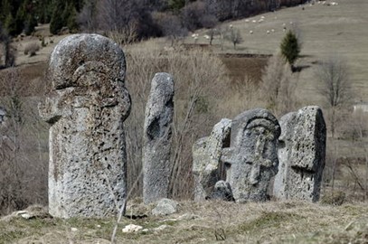
The Stecci Graveyards, a UNESCO World Heritage site in Bosnia and Herzegovina, Croatia, Serbia, and Montenegro, recognized in 2016, are 28 medieval cemeteries featuring over 70,000 ornate tombstones from the 12th to 16th centuries. These limestone stecci, adorned with carvings of crosses, figures, and inscriptions, reflect a unique Balkan Christian burial tradition blending local and external influences. This transnational site showcases the region’s cultural heritage, preserving a striking medieval art for... Read More
Silk Roads Chang'an Tianshan Corridor
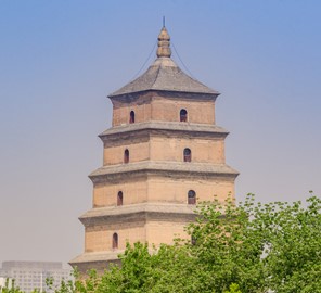
Silk Roads, a UNESCO World Heritage site in China, Kazakhstan, and Kyrgyzstan, recognized in 2014, is a segment of the ancient trade network linking Chang’an-Tianshan corridors, active from the 2nd century BCE to the 16th century CE. Featuring 33 sites like caravan cities, Buddhist caves, and fortifications, it reflects the exchange of goods, ideas, and cultures across deserts and mountains. This transnational site showcases Central Asia’s pivotal role in connecting East and West, preserving a legacy of his... Read More
Venetian Works of Defence
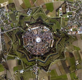
Venetian Works of Defence, a UNESCO World Heritage site in Croatia, Italy, and Montenegro, recognized in 2017, are 15 fortified sites built by the Venetian Republic from the 15th to 17th centuries to protect its maritime trade routes. Featuring star-shaped forts, city walls, and coastal bastions like those in Kotor and Zadar, they showcase advanced military architecture. This transnational site reflects Venice’s strategic legacy, blending engineering prowess with historical significance across the Adriatic ... Read More
Stone Circles of Senegambia
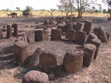
The Stone Circles of Senegambia, a UNESCO World Heritage site in Gambia and Senegal, recognized in 2006, are over 1,000 megalithic circles across four sites, built between the 3rd century BCE and 16th century CE. Featuring laterite stone pillars arranged in rings, often near burial mounds, they reflect a mysterious ancient tradition of West African communities. This transnational site showcases the region’s archaeological heritage, offering a glimpse into a lost culture’s rituals and engineering skills.
Muskauer Park
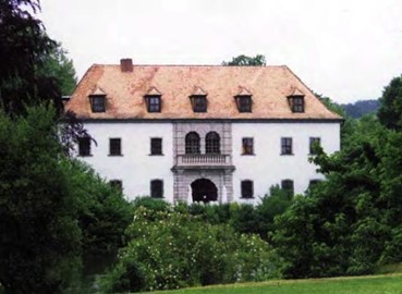
Muskauer Park, a UNESCO World Heritage site in Germany and Poland, recognized in 2004, is a 19th-century landscape garden straddling the Neisse River, designed by Prince Hermann von Pückler-Muskau from 1815 to 1844. Blending English-style parkland with castles, bridges, and woodlands, it reflects Romantic ideals of nature and human harmony. This transnational site showcases the region’s cultural heritage, preserving a pioneering example of landscape architecture across borders.
Frontiers of the Roman Empire
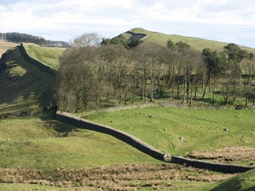
The Frontiers of the Roman Empire, a UNESCO World Heritage site in Europe, recognized in phases from 1987 to 2021, spans sites in Germany, the UK, Austria, and Slovakia, tracing the Roman Empire’s northern boundaries from the 1st to 5th centuries CE. Featuring Hadrian’s Wall, the Antonine Wall, and the Upper German-Raetian Limes, these fortifications, forts, and settlements reflect Rome’s military engineering and cultural reach. This transnational site showcases Europe’s ancient heritage, preserving a vast ... Read More
Rome
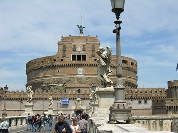
The Historic Centre of Rome, the Properties of the Holy See in that City Enjoying Extraterritorial Rights and San Paolo Fuori le Mura, a UNESCO World Heritage site in Italy, recognized in 1980 and extended in 1990, encompasses Rome’s ancient core and key Vatican properties. Featuring iconic landmarks like the Colosseum, Roman Forum, and St. Peter’s Basilica, it reflects over 2,800 years of urban, architectural, and religious history. This site showcases Italy’s unparalleled cultural heritage, blending Roman... Read More
Rhaetian Railway
The Rhaetian Railway, a UNESCO World Heritage site in Italy and Switzerland, recognized in 2008, is a scenic rail network featuring the Albula and Bernina lines, completed in 1910, winding through the Alps. With stunning viaducts, tunnels, and spiral loops like the Landwasser Viaduct, it showcases early 20th-century engineering amid breathtaking mountain landscapes. This transnational site reflects a harmonious blend of technology and nature, highlighting the region’s cultural and industrial heritage.
Curonian Spit
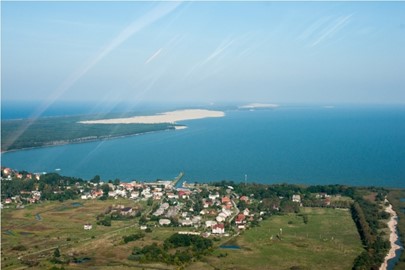
The Curonian Spit, a UNESCO World Heritage site in Lithuania and Russia, recognized in 2000, is a narrow, 98-kilometer sand dune peninsula separating the Curonian Lagoon from the Baltic Sea. Shaped by wind and human efforts since the 19th century, its shifting dunes, forests, and fishing villages reflect a fragile balance of nature and culture. This transnational site showcases the region’s unique ecological and historical heritage, preserving a dynamic coastal landscape across borders.
Wooden Tserkvas
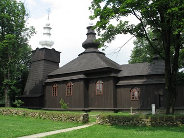
Wooden Tserkvas, a UNESCO World Heritage site in Poland and Ukraine, recognized in 2013, are 16 intricately crafted wooden churches built between the 16th and 19th centuries by Eastern Christian communities. Featuring steep roofs, bell towers, and ornate interiors, they blend Byzantine influences with local carpentry traditions in the Carpathian region. This transnational site reflects the region’s rich religious and architectural heritage, preserving a unique cultural legacy across borders.
