region :: asia and the pacific
Beijing Central Axis
The Beijing Central Axis, a UNESCO World Heritage site in China, is a historic urban planning marvel stretching through the heart of the city. This centuries-old north-south axis aligns key architectural landmarks, including the Forbidden City, Tiananmen Square, and the Temple of Heaven, symbolizing imperial power and cosmological harmony. Designated in 2024, it reflects traditional Chinese principles of symmetry and balance, serving as a cultural and historical spine that has shaped Beijing’s development f... Read More
Badain Jaran Desert
The Badain Jaran Desert, a UNESCO World Heritage site in China, is renowned for its striking natural features, including some of the tallest stationary sand dunes on Earth and a high concentration of colorful inter-dunal lakes. This hyper-arid region showcases ongoing geological processes, with its 'singing sands' and wind-sculpted landforms adding to its unique allure. Recognized in 2024, it highlights China's ecological diversity and serves as a key area for studying desert evolution and biodiversity.
Moidams
Moidams, the Mound-Burial System of the Ahom Dynasty, a UNESCO World Heritage Site in India, is a unique funerary tradition located in Assam. These grass-covered burial mounds, dating back to the 13th century, serve as the resting place of Ahom kings and nobles, reflecting the dynasty's rich history and Tai-Ahom cultural heritage. They symbolize an enduring link to India's ancient past and traditions.
Hegmataneh
Hegmataneh, a UNESCO World Heritage site in Iran, is an ancient archaeological mound in modern-day Hamadan, recognized as the 28th Iranian site on the list in July 2024. Spanning 75 hectares, this 3,000-year-old city was the capital of the Median Empire and later a summer retreat for the Achaemenid and Parthian empires. Featuring a massive mud-brick defensive wall and a grid-like urban layout, Hegmataneh offers a rare glimpse into ancient Persian civilization, with much of its history still awaiting excavat... Read More
Sado Island Gold Mines
The Sado Island Gold Mines, a UNESCO World Heritage site in Japan inscribed in July 2024, lie off Niigata Prefecture on a volcanic island in the Sea of Japan. Operational from 1601 until 1989, these mines, once the world’s largest gold producer, yielded 78 tons of gold and 2,330 tons of silver, funding the Tokugawa Shogunate during the Edo period (1603–1868). Featuring unmechanized mining techniques, preserved tunnels, and the striking Doyu no Warito—a hand-carved, V-shaped valley—the site reflects Japan’s ... Read More
Niah National Park
Niah National Park, a UNESCO World Heritage site in Sarawak, Malaysia, inscribed in July 2024, encompasses a vast limestone karst landscape with caves that have revealed human history spanning over 40,000 years. Located on Borneo, the park’s Great Cave houses the oldest modern human remains in Southeast Asia, dating to 40,000 BCE, alongside rock art and evidence of prehistoric foraging and trade. Its biodiversity, including rare bats, birds, and edible-nest swiftlets, complements its archaeological signific... Read More
Phu Phrabat
Phu Phrabat, a UNESCO World Heritage site in Thailand’s Udon Thani province, inscribed in July 2024, is a historical park showcasing the Sima stone tradition of the Dvaravati period (7th–11th centuries CE). Located in the Phu Phan mountains, it features unique rock formations, prehistoric cave paintings, and the world’s largest collection of Sima stones—sacred Buddhist boundary markers—set within a forested landscape. As Thailand’s eighth UNESCO site and fifth cultural listing, it reflects ancient human set... Read More
Cold Winter Deserts of Turan
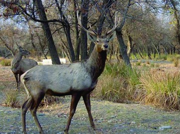
The Cold Winter Deserts of Turan, a UNESCO World Heritage site inscribed in September 2023, span Kazakhstan, Turkmenistan, and Uzbekistan, covering 14 protected areas across Central Asia’s temperate zone. Recognized as the world’s first listed cold winter desert, this transnational site stretches over 1,500 km, showcasing extreme climates with frigid winters and scorching summers, alongside diverse desert ecosystems. Home to unique flora like saxaul forests and endangered fauna such as the goitered gazelle ... Read More
Tugay forests
The Tugay Forests of the Tigrovaya Balka Nature Reserve, a UNESCO World Heritage site in Tajikistan inscribed in September 2023, span 50,000 hectares near the Afghan border along the Vakhsh River. As Tajikistan’s fourth UNESCO listing and first natural site, these rare floodplain ecosystems feature Asia’s largest tugay forests—riverine woodlands of poplar, tamarisk, and oleaster—supporting endangered species like the Bukhara deer and goitered gazelle. Protected since 1938, this biodiversity hotspot preserve... Read More
Si Thep
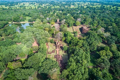
Si Thep, a UNESCO World Heritage site in Thailand’s Phetchabun province, inscribed in September 2023, is an ancient twin-town settlement from the Dvaravati Empire (6th–10th centuries CE). Located 340 km north of Bangkok, it features an Inner and Outer Town with moats, the massive Khao Klang Nok monument, and the Khao Thamorrat Cave, showcasing a blend of Indian-influenced architecture and the distinctive Si Thep School of Art. As Thailand’s seventh UNESCO site, this 1,500-year-old complex highlights its his... Read More
Sacred Ensembles of the Hoysalas
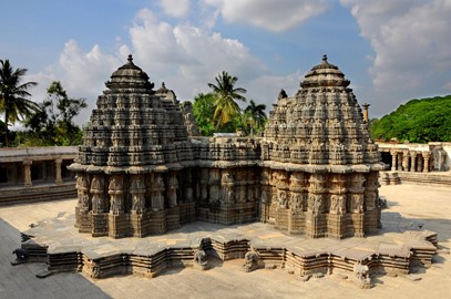
The Sacred Ensembles of the Hoysalas, a UNESCO World Heritage site in India inscribed in September 2023, comprise three 12th–13th-century temples—Chennakeshava in Belur, Hoysaleshwara in Halebid, and Keshava in Somanathapura—in Karnataka. Built by the Hoysala Empire, these masterpieces of Hindu architecture feature intricate soapstone carvings, stellate plans, and sanctuaries dedicated to Vishnu and Shiva, reflecting a peak of artistic and engineering innovation. As India’s 42nd UNESCO site, they highlight ... Read More
Yogyakarta
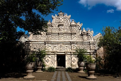
The Cosmological Axis of Yogyakarta, a UNESCO World Heritage site in Indonesia inscribed in September 2023, is a 6-km north-south corridor in southern-central Java, established in the 18th century by Sultan Mangkubumi. Linking Mount Merapi to the Indian Ocean, it centers on the Kraton (Sultan’s Palace) and includes landmarks like Tugu Monument and Panggung Krapyak, reflecting Javanese cosmological beliefs about life cycles and harmony. As Indonesia’s sixth cultural UNESCO site, this living heritage site sho... Read More
Silk Roads: Zarafshan Karakum Corridor
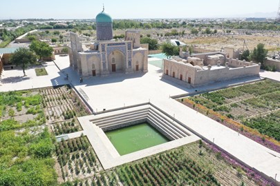
The Silk Roads: Zarafshan-Karakum Corridor, a UNESCO World Heritage site spanning Tajikistan, Turkmenistan, and Uzbekistan, is an 866-kilometer stretch of the ancient Silk Road, active from the 2nd century BCE to the 16th century CE. This corridor, running along the Zarafshan River and through the Karakum Desert to the Merv Oasis, features 31 sites, including medieval cities, caravanserais, and Sogdian settlements. Recognized for its role in facilitating trade and cultural exchange across diverse landscapes... Read More
Koh Ker
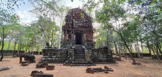
Koh Ker, a UNESCO World Heritage site in Cambodia, is a remote archaeological complex 100 kilometers northeast of Angkor, serving as the Khmer Empire’s capital from 928 to 944 CE under King Jayavarman IV. Spanning 35 square kilometers of dense forest, it features over 180 monuments, including the iconic seven-tiered Prasat Thom pyramid, sculptural lingams, and intricately carved temples. Recognized for its monumental architecture and artistic innovation, Koh Ker reflects a brief but significant shift in Khm... Read More
Tea Forests of the Jingmai Mountain
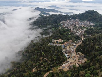
The Tea Forests of Jingmai Mountain, a UNESCO World Heritage site in China’s Yunnan Province, is a 1,513-hectare cultural landscape where ancient tea cultivation thrives. Developed over a millennium by the Bulang, Dai, and Hani peoples, it features old-growth tea forests, traditional villages, and sacred groves atop the mist-shrouded Jingmai and Mangjing mountains. Recognized in 2023 for its sustainable agroforestry and unique tea ancestor worship, this site exemplifies a harmonious blend of nature, culture... Read More
Santiniketan
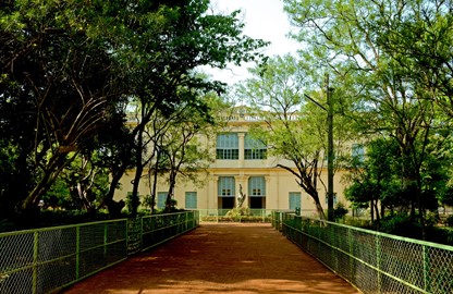
Santiniketan, a UNESCO World Heritage site in India’s West Bengal, is a 37-hectare cultural landscape founded by poet Rabindranath Tagore in 1901 as an experimental school, later evolving into Visva-Bharati University by 1921. Recognized in 2023, it blends traditional Indian architecture with nature-inspired open-air classrooms, reflecting Tagore’s vision of holistic education rooted in creativity, humanism, and harmony with the environment. This rural retreat, surrounded by ashram-style buildings and artis... Read More
Persian Caravanserai
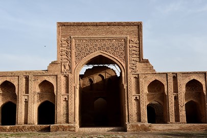
The Persian Caravanserai, a UNESCO World Heritage site in Iran, comprises 54 historic roadside inns spanning the country, recognized in 2023 for their role along ancient trade routes from the Achaemenid era (550-330 BCE) to the 19th century. These fortified structures, strategically spaced 30-40 kilometers apart, feature robust brick and stone architecture with courtyards, stables, and domed halls, offering shelter to travelers and merchants. Exemplifying Persian engineering and cultural exchange, sites lik... Read More
Deer Stone Monuments
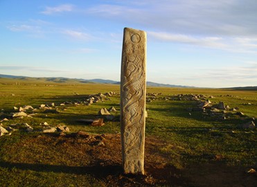
The Deer Stone Monuments, a UNESCO World Heritage site in Mongolia, are ancient megaliths scattered across the northern steppes, dating from 1200 to 600 BCE. Recognized in 2023, these 1- to 4-meter-tall stones, adorned with stylized deer carvings, are part of Bronze Age complexes in the Khangai Ridge, including burial mounds (khirgisuurs) and sacrificial altars. Found primarily at sites like Uushigiin Övör and Khoid Tamir, they reflect the ceremonial and funerary practices of Eurasian nomads, offering a uni... Read More
Gaya Tumuli
The Gaya Tumuli, a UNESCO World Heritage site in South Korea, comprises seven clusters of ancient burial mounds across Gyeongsang Province, dating from the 1st to 6th centuries CE during the Gaya Confederacy. Recognized in 2023, these 35- to 65-meter-wide tumuli, built for elite rulers, feature stone-lined chambers and artifacts like gold jewelry and armor, reflecting Gaya’s sophisticated culture and trade networks. Set in urban and rural landscapes, they illustrate a distinct funerary tradition on the Kore... Read More
Quanzhou
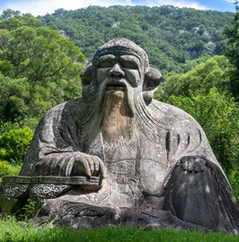
Quanzhou: Emporium of the World in Song-Yuan China, a UNESCO World Heritage site in Fujian Province, recognized in 2021, is a historic port city that thrived as a global trade hub from the 10th to 14th centuries during the Song and Yuan dynasties. Spanning 22 sites—including docks, pagodas, mosques, and archaeological remains—it showcases maritime infrastructure and a multicultural legacy blending Chinese, Islamic, and Hindu influences. This 540-hectare area highlights Quanzhou’s pivotal role in the Maritim... Read More
Ramappa Temple
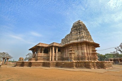
The Ramappa Temple, a UNESCO World Heritage site in India, recognized in 2021, is a 13th-century sandstone shrine in Telangana dedicated to Lord Shiva, built under the Kakatiya dynasty. Known officially as Rudreswara Temple, it features intricate carvings, floating bricks, and a star-shaped sanctum, showcasing advanced medieval engineering and artistic mastery. Named after its architect, Ramappa, this well-preserved structure exemplifies South Indian temple architecture, reflecting the Kakatiya era’s cultur... Read More
Dholavira
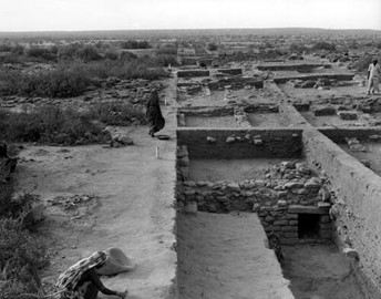
Dholavira: a Harappan City, a UNESCO World Heritage site in India, recognized in 2021, is an ancient urban settlement in Gujarat from the Harappan Civilization, thriving between 3000 and 1500 BCE. This well-preserved archaeological site features sophisticated water management systems, a fortified citadel, and large-scale structures, reflecting advanced urban planning and engineering. One of the five largest Indus Valley cities, Dholavira offers a rare glimpse into Bronze Age life, trade, and culture in the ... Read More
Trans Iranian Railway
The Trans-Iranian Railway, a UNESCO World Heritage site in Iran, recognized in 2021, is a historic rail network completed in 1938 under Reza Shah, linking the Persian Gulf to the Caspian Sea. Spanning diverse terrains—mountains, deserts, and valleys—it features over 174 bridges, 186 tunnels, and bold engineering feats like the Three Golden Lines spiral. Built to boost trade and modernization, this 20th-century marvel reflects Iran’s industrial ambition and technical prowess, connecting remote regions while ... Read More
Hawraman/Uramanat
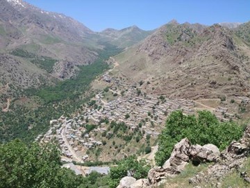
Hawraman/Uramanat, a UNESCO World Heritage site in Iran, recognized in 2021, is a rugged mountainous region in western Iran preserving the ancient cultural landscape of the Kurdish Hawrami people. Featuring terraced villages, dry-stone architecture, and sacred sites dating back over 3,000 years, it reflects a harmonious blend of human adaptation, agriculture, and pastoralism in a harsh environment. This living heritage, with its unique traditions and stepped settlements, showcases Iran’s diverse cultural id... Read More
Amami Oshima Island
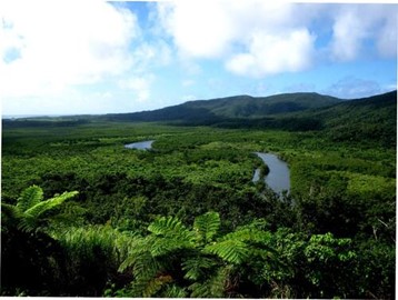
Amami-Oshima Island, a UNESCO World Heritage site in Japan, recognized in 2021, is a subtropical island in the Ryukyu Archipelago renowned for its exceptional biodiversity and ancient ecosystems. Part of a four-island listing with Tokunoshima, Iriomote, and northern Okinawa, it hosts unique species like the Amami rabbit and Ryukyu long-tailed giant rat, thriving in dense laurel forests and mangroves. This pristine natural haven reflects millions of years of ecological isolation, offering a living testament ... Read More


