region :: europe and north america
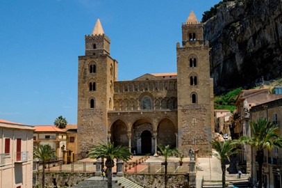
Palermo, Cefalú and Monreale
Palermo, Cefalú and Monreale, a UNESCO World Heritage site in Italy, showcases a unique blend of Norman and Byzantine architectural styles from the 12th century. The site includes a series of structures, such as the Palermo Cathedral, the Cappella Palatina, and the Palazzo dei Normanni, reflecting the multicultural influences of Sicily’s history. These buildings feature intricate mosaics and medieval European elements, making them standout examples of cultural synthesis. This historic ensemble highlights th... Read More
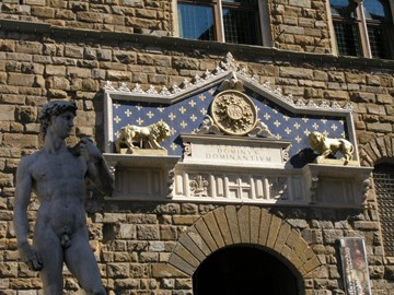
Florence
The Historic Centre of Florence, a UNESCO World Heritage site in Italy, is renowned for its exceptional artistic and architectural legacy. This cradle of the Renaissance boasts iconic landmarks like the Cathedral of Santa Maria del Fiore, adorned with Brunelleschi’s magnificent dome, and the Uffizi Gallery, home to masterpieces by Botticelli and Michelangelo. Its well-preserved medieval streets, palaces, and churches reflect centuries of cultural and historical significance, making it a global treasure of h... Read More
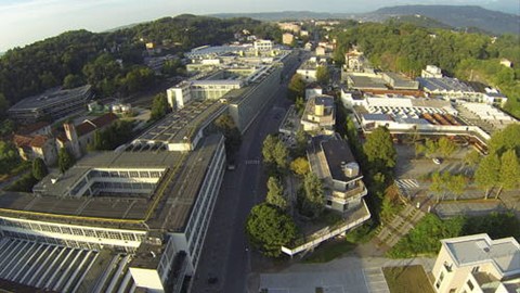
Ivrea
Ivrea, a UNESCO World Heritage site in Italy, is renowned for its historical significance as an industrial city, exemplifying 20th-century urban planning and architecture. It gained prominence through the Olivetti company, which produced iconic typewriters and office equipment, integrating innovative design with social ideals. The site features a blend of modernist buildings, worker housing, and public spaces, reflecting a pioneering vision of industry and community coexistence. Today, Ivrea stands as a tes... Read More
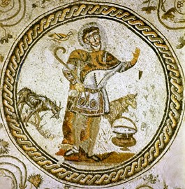
Aquileia
Aquileia, a UNESCO World Heritage site in Italy, is an ancient Roman city founded in 181 BC, renowned for its historical and archaeological significance. It features remarkably preserved ruins, including a grand basilica with stunning 4th-century mosaics, one of the largest and most impressive of its kind from the early Christian era. Once a thriving trade and military hub, Aquileia offers a window into Roman urban life and its transition into a key Christian center. Today, its archaeological remains and mu... Read More
Riga
The Historic Centre of Riga, a UNESCO World Heritage site in Latvia, exemplifies a well-preserved medieval urban landscape blended with Art Nouveau architecture. This vibrant cultural hub features cobblestone streets, historic churches, and elegant buildings that reflect its past as a key trading center in Northern Europe. Recognized for its architectural diversity and historical significance, it showcases centuries of artistic and urban development.
Kernavė
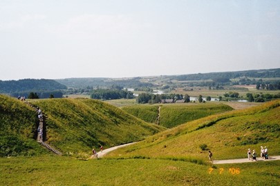
Kernavė, a UNESCO World Heritage site in Lithuania, is an archaeological treasure showcasing over 10,000 years of human settlement, from the late Palaeolithic period to the Middle Ages. Once a thriving medieval capital of the Grand Duchy of Lithuania, it features five impressive hill forts, ancient settlements, and burial sites along the Neris River, reflecting the region’s rich pagan and Christian history. Recognized in 2004, Kernavė stands as a testament to the evolution of Baltic culture and is often cal... Read More
Vilnius
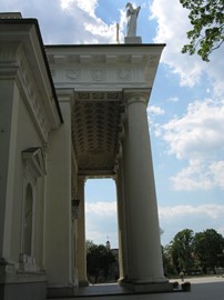
Vilnius Historic Centre, a UNESCO World Heritage site in Lithuania, is renowned for its well-preserved medieval architecture and rich cultural history. The old town features a blend of Gothic, Renaissance, and Baroque styles, with notable landmarks like the Cathedral Square and Gediminas Tower. Its cobblestone streets and historic buildings reflect centuries of European influence, making it a significant cultural treasure.
Luxembourg Old Quarters
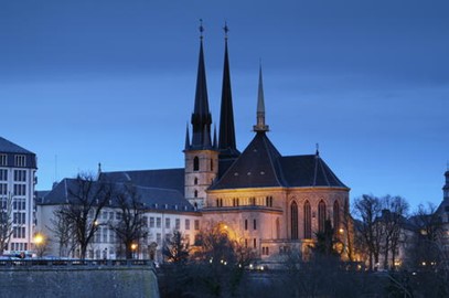
Luxembourg Old Quarters, a UNESCO World Heritage site, is a historic gem featuring a well-preserved medieval fortress, winding cobblestone streets, and charming architecture. This picturesque district showcases a blend of military heritage and cultural landmarks, including ancient ramparts and underground casemates, reflecting its strategic past. Visitors can explore its scenic beauty and rich history, making it a must-see destination in Luxembourg.
Hal Saflieni Hypogeum
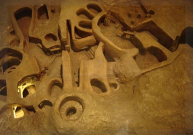
The Hal Saflieni Hypogeum, a UNESCO World Heritage site in Malta, is a remarkable prehistoric underground sanctuary dating back to around 3600–2500 BC. Discovered in 1902, this multi-level complex was carved from solid limestone and served as both a burial site and a place of worship, housing the remains of over 7,000 individuals alongside intricate chambers like the 'Holy of Holies.' Its well-preserved acoustics and red-ochre wall paintings offer a rare glimpse into Neolithic culture and religious practice... Read More
Valletta
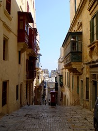
Valletta, a UNESCO World Heritage site in Malta, is a historic fortified city renowned for its Baroque architecture, grand palaces, and stunning harbors. Founded in the 16th century by the Knights of St. John, it boasts iconic landmarks like St. John’s Co-Cathedral and the Grand Master’s Palace, reflecting its rich cultural and military past. Today, this vibrant capital blends history with modernity, offering visitors a captivating glimpse into its storied legacy.
Megalithic Temples of Malta
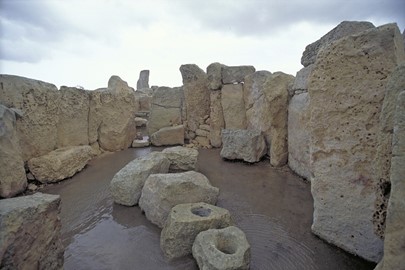
The Megalithic Temples of Malta, recognized as a World Heritage site, are among the oldest free-standing structures in the world, dating back to 3600–2500 BCE. Built by a prehistoric culture, these temples showcase advanced architectural techniques with large limestone blocks and intricate designs. They served as ceremonial and religious centers, offering insight into early human civilization and its spiritual practices. Today, they stand as a testament to Malta's rich archaeological legacy.
Durmitor
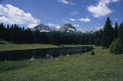
Durmitor National Park, a UNESCO World Heritage site in Montenegro, is renowned for its stunning natural beauty, featuring dramatic limestone peaks, deep canyons, and glacial lakes. The park is home to Tara River Canyon, one of the deepest gorges in Europe, and boasts diverse flora and fauna, including rare species like the Balkan chamois. Its rugged terrain offers opportunities for hiking, skiing, and rafting, making it a haven for outdoor enthusiasts. This protected landscape preserves both ecological ric... Read More
Kotor
Kotor, a UNESCO World Heritage site in Montenegro, is a well-preserved medieval town nestled at the head of a stunning bay. Its historic old town features a maze of narrow cobblestone streets, ancient churches, and fortified walls that climb the surrounding hills. Founded in the 5th century, Kotor showcases a blend of Roman, Byzantine, and Venetian influences, evident in its architecture and cultural heritage. Today, it stands as a testament to its rich history, attracting visitors with its picturesque char... Read More
Schoklands
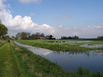
Schokland, a UNESCO World Heritage Site in the Netherlands, is a former island in the Zuiderzee that symbolizes the Dutch struggle against water. Once a thriving settlement, it was abandoned in 1859 due to relentless flooding, only to be reclaimed as part of the Noordoostpolder in the 1940s. Rich with over 160 archaeological sites, it preserves traces of human habitation from prehistoric times, including ancient footprints and tools, alongside historic structures like dykes and terps, showcasing a unique bl... Read More
Defence Line of Amsterdam
The Defence Line of Amsterdam, a UNESCO World Heritage site in the Netherlands, is a historic military fortification system constructed between 1880 and 1920. Designed to protect the capital from invasion, it consists of a ring of 42 forts, intricate waterways, and floodable zones that could be inundated to deter enemies. This innovative defense strategy, known as the Dutch Water Line, showcases exceptional engineering and spatial planning, reflecting the Netherlands' military heritage and adaptation to its... Read More
Kinderdijk Elshout
The Mill Network at Kinderdijk-Elshout, a UNESCO World Heritage site, showcases a remarkable system of 19 well-preserved windmills dating back to the 18th century. This historic network exemplifies Dutch ingenuity in water management, using wind power to drain low-lying land and prevent flooding. The site includes traditional mills, pumping stations, and dikes, illustrating centuries-old engineering techniques still admired today. It stands as a testament to human adaptation to challenging environmental con... Read More
Willemstad
Willemstad, a UNESCO World Heritage site in Curaçao, is a vibrant Caribbean city renowned for its well-preserved colonial architecture and colorful waterfront buildings. Founded in the 17th century as a Dutch trading hub, its historic center features a unique blend of European and tropical influences, reflected in landmarks like the Queen Emma Bridge and the Mikvé Israel-Emanuel Synagogue, one of the oldest in the Americas. The city’s strategic harbor and rich cultural heritage make it a standout destinatio... Read More
Wouda Steam Pumping Station
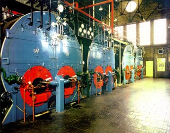
The Wouda Steam Pumping Station, a UNESCO World Heritage Site in the Netherlands, is the world’s largest steam-powered pumping station still in operation. Opened in 1920, it showcases advanced Dutch hydraulic engineering with a capacity to pump 4 million liters of water per minute, originally designed to manage flooding. Its well-preserved steam engines and Amsterdam School architecture highlight its historical and technological significance. Today, it operates occasionally to supplement modern systems, sym... Read More
Beemster Polder
The Beemster Polder, a UNESCO World Heritage site in the Netherlands, is a remarkable example of Dutch ingenuity in land reclamation. Created in the early 17th century by draining a lake with windmills, this site showcases a meticulously planned landscape of fields, roads, canals, and dykes. Its geometric design reflects the Renaissance-era principles of order and symmetry, while its preservation highlights its historical significance as one of the first large-scale polders, demonstrating advanced water man... Read More
Rietveld Schröder House
The Rietveld Schröder House, a UNESCO World Heritage site in the Netherlands, is an iconic example of De Stijl architecture, designed by Gerrit Rietveld in 1924. Commissioned by Truus Schröder, it features a revolutionary open-plan design with movable walls, emphasizing functionality, simplicity, and abstract geometric forms. Its use of primary colors and clean lines reflects the artistic principles of the De Stijl movement, pioneered by Piet Mondrian. The house stands as a testament to innovative modernist... Read More
Amsterdam Canal Ring
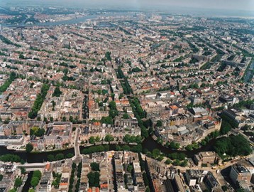
The Amsterdam Canal Ring, a UNESCO World Heritage site in the Netherlands, is a remarkable 17th-century urban planning masterpiece. This historic network of canals, lined with elegant merchant houses, showcases innovative water management and architectural beauty. Constructed during the Dutch Golden Age, it features concentric canals, bridges, and tree-lined streets that reflect the city’s economic prosperity and cultural heritage. Today, it remains a vibrant, functional part of Amsterdam, attracting visito... Read More
Van Nellefabriek
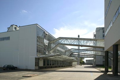
The Van Nellefabriek, a UNESCO World Heritage Site in the Netherlands, is an iconic example of 20th-century industrial architecture, built in the 1920s. Designed with steel and glass facades using the innovative curtain wall principle, it was conceived as an 'ideal factory' that prioritized daylight and open, adaptable workspaces to enhance working conditions. This modernist structure reflects the functionalist culture of the interwar period and highlights the Netherlands' historical role in processing and ... Read More
Ohrid
The Ohrid region, a UNESCO World Heritage site spanning Albania and Macedonia, is renowned for its unique blend of natural beauty and cultural significance. Lake Ohrid, one of Europe’s oldest and deepest lakes, anchors the area with its crystal-clear waters and rich biodiversity. The region boasts a wealth of historical treasures, including ancient churches, monasteries, and archaeological sites that reflect its Byzantine and Ottoman influences. This picturesque destination attracts visitors with its serene... Read More
Urnes Stave Church
Urnes Stave Church, a UNESCO World Heritage site, is a remarkably preserved example of 12th-century Scandinavian wooden architecture. Built around 1130, it showcases intricate wood carvings, including the famous 'Urnes style' animal motifs on its north portal, blending Norse and Christian influences. The church stands as a testament to medieval craftsmanship, with its stave construction—a technique using vertical wooden posts—demonstrating both durability and artistic sophistication. Today, it serves as a h... Read More
Bryggen
Bryggen, a UNESCO World Heritage site in Norway, is a historic waterfront district renowned for its well-preserved wooden buildings dating back to the Hanseatic League era. This vibrant area showcases a unique blend of Scandinavian and German architectural influences, with colorful gabled structures lining the wharf. Once a bustling trading hub for merchants, it now serves as a cultural landmark, housing museums, shops, and restaurants that reflect its rich maritime heritage. Its significance lies in its re... Read More
